The Memphis Floods 1912 1913 — A Mid-South River History
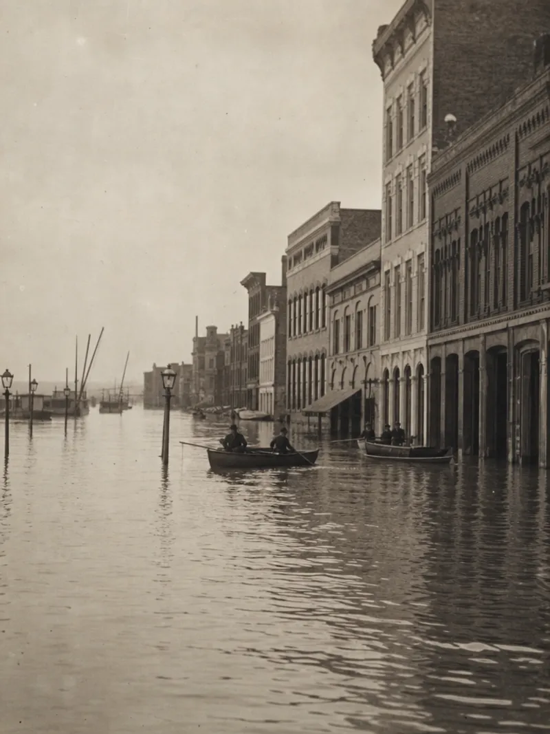
The Memphis Floods 1912 1913 rank among the most severe flood events in Mid-South history. This collection preserves firsthand accounts and photographs from both years. The Mississippi River rose to levels that reshaped the Memphis riverfront and displaced thousands of residents in a single flood season.
The History of the Memphis Floods 1912 1913
In April 1912, sudden snowmelt combined with high water on the Ohio, Cumberland, and Tennessee rivers to send the Mississippi over its banks throughout the valley. In Memphis, the river crested for three days, April 6 through 9, at 45.3 feet. Twenty-five city blocks went under water, 1,300 people were made homeless, and thousands more lost their jobs as riverfront factories and businesses shut down.
The Even Worse Flood of 1913
The Memphis Floods 1912 1913 were not a single event but a punishing two-year sequence. The 1913 flood became the largest in U.S. history to that point, striking before much of the levee damage from the previous year had been repaired. Together, the two floods demonstrated how much reinforcement the region's levee system still needed.
Mid-South Views of the Flood Years
Much of what is known visually about the Memphis floods of 1912 and 1913 comes from a period photograph and postcard series known as Mid-South Views. The 1912 flood was the first major Mississippi River flood to be photographed in any real depth, and those Mid-South Views images remain some of the clearest surviving records of the disaster. This visual record is a defining part of the Memphis Floods 1912 1913 story preserved in this archive.
How Long the Recovery Took
What the photographs cannot show is how long recovery took. Levee repair ran on through the following seasons. The 1913 crest arrived while much of the 1912 damage was still open. This archive therefore files the two years as one record rather than two.
See the complete Shelby County records index for census, obituary, cemetery, and other historical pages across the rest of the county.
Frequently Asked Questions
How bad were the Memphis floods of 1912 and 1913?
What caused the 1912 Memphis flood?
Was the 1913 flood worse than the 1912 flood in Memphis?
What are the "Mid-South Views" referenced in this flood archive?
How did the Memphis floods of 1912-1913 affect the city?
- County seat
- Memphis, TN
- Crest
- 45.3 ft (Apr 1912)
- Category
- Historical Event